Lenten Campaign 2025
This content is free of charge, as are all our articles.
Support us with a donation that is tax-deductible and enable us to continue to reach millions of readers.
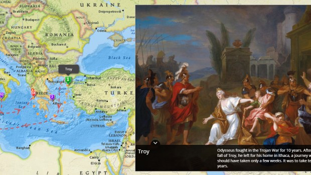
After spending ten years waging war, Ulysses finally embarked on his return to Ithaca. A trip that should have lasted only a few weeks, traveling across the Aegean, the Mediterranean and the Ionian Sea until he reached the west coast of Greece, however, ended up being, strictly speaking, an odyssey. We all know the story. Kind of.

Read more:
A map of Paul’s missionary journeys, London-Underground Style
Thanks to this map, published by ESRI, following Ulysses’ convoluted journey trying to get back home is a bit easier (although it lacks the aesthetic pleasure of reading Homer, sure).
You can visit the map here. It’s quite fun indeed.

